Share on Facebook
 Share on X
 Share by Email
 Share on Google Classroom
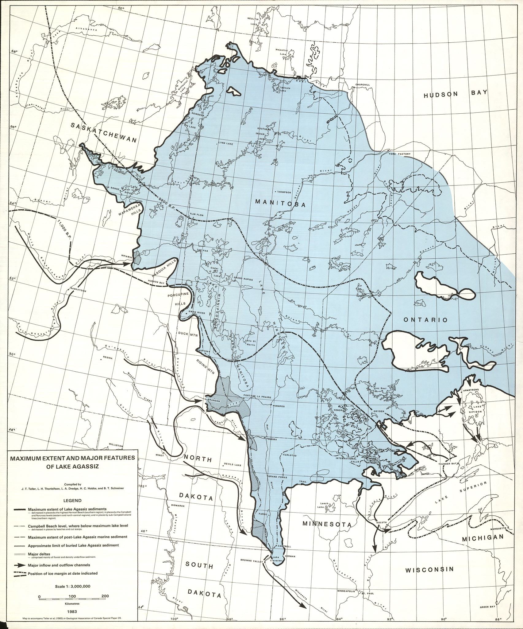
Formed 11,500 years ago, Lake Agassiz was the largest glacial lake in North America, at about 1,500 km long, over 1,100 km wide and 210 m deep. Its location covered parts of what is now Manitoba, Ontario, Saskatchewan, North Dakota and Minnesota.
Location and Size
Lake Agassiz was formed 11,500 years ago in front of the northeastwardly retreating Laurentide Ice Sheet, which acted as a dam. The lake covered much of Manitoba, northwestern Ontario, parts of eastern Saskatchewan and North Dakota, and northwestern Minnesota.
At its largest, Lake Agassiz was about 1,500 km long, over 1,100 km wide and about 210 m deep.
Evolution
Lake Agassiz’s history is complicated by the behaviour of the ice sheet, which at times re-advanced and affected lake levels and drainage systems. Several outlet channels and about 35 beach ridges at different elevations have been identified. Some of these, such as the prominent Campbell Beach Ridge, in Manitoba, can be traced for hundreds of kilometres.
For the first 500 years, drainage was southward through the Minnesota River Valley. As glacial retreat continued into northwestern Ontario, the lake lowered and drainage shifted eastward into Lake Superior via various channels in the Lake Nipigon basin area. There may have also been a northwestward drainage into the Arctic Ocean via the Mackenzie River.
About 9,900 years ago, a re-advance blocked the eastern outlet, raising the lake to earlier levels. Between 9,500 and 9,200 years ago, the ice sheet rapidly disintegrated and eastern outlets were once again opened. As deglaciation continued, lower lake levels were established and the overflow drainage shifted along a route across northern Ontario into the valley of St. Lawrence River. The final drainage of the lake occurred about 7,700 years ago north into Hudson Bay. Only remnants, such as Lake Winnipeg, remain today. The former lake basin and sediments have provided valuable agricultural land.
(See also Glaciers in Canada; Glaciation.)