
Browse "History"
-
Article
Frank Slide Interpretive Centre
The Frank Slide Interpretive Centre is located on the site of the FRANK SLIDE, in the municipality of CROWSNEST PASS, Alta. On 29 April 1903 part of Turtle Mountain broke away and slid through part of the mining community of Frank. There is still considerable controversy over the cause of the slide.
"https://thecanadianencyclopedia.ca/images/tce_placeholder.jpg?v=e9dca980c9bdb3aa11e832e7ea94f5d9" // resources/views/front/categories/view.blade.php
https://thecanadianencyclopedia.ca/images/tce_placeholder.jpg?v=e9dca980c9bdb3aa11e832e7ea94f5d9
-
Article
Franklin Search
The disappearance in 1845 of Sir John Franklin and his crew in the Canadian Arctic set off the greatest rescue operation in the history of exploration. More than 30 expeditions over two decades would search by land and sea for clues as to his fate, in the process charting vast areas of the Canadian Arctic and mapping the complete route of the Northwest Passage. The search for clues continued into the 20th and 21st centuries. On 9 September 2014, it was announced that one of the expedition ships, later identified as the HMS Erebus, had been found off King William Island. On 12 September 2016, a team from the Arctic Research Foundation announced that they had located the Terror in Nunavut's Terror Bay, north of where the Erebus was found.
"https://d3d0lqu00lnqvz.cloudfront.net/media/media/61cafc88-db89-4bf1-a339-8d82f7bc6007.jpg" // resources/views/front/categories/view.blade.php
https://d3d0lqu00lnqvz.cloudfront.net/media/media/61cafc88-db89-4bf1-a339-8d82f7bc6007.jpg
-
Article
Fraser River Gold Rush
In 1858, around 30,000 gold seekers flooded the banks of the Fraser River from Hope to just north of Lillooet in British Columbia’s first significant gold rush. Although it dissipated by the mid-1860s, the Fraser River Gold Rush had a significant impact on the area’s Indigenous peoples and resulted in the Fraser Canyon War. Fears that the massive influx of American miners would lead the United States to annex the non-sovereign British territory known as New Caledonia also resulted in the founding of British Columbia as a colony on 2 August 1858 (see The Fraser River Gold Rush and the Founding of British Columbia). By the mid-1860s, the Fraser Rush collapsed, and British Columbia sank into a recession.
"https://d3d0lqu00lnqvz.cloudfront.net/media/new_article_images/FraserCanyonWar/Fraser Canyon near Chapmans Bar, Daniel Marshall(1).jpg" // resources/views/front/categories/view.blade.php
https://d3d0lqu00lnqvz.cloudfront.net/media/new_article_images/FraserCanyonWar/Fraser Canyon near Chapmans Bar, Daniel Marshall(1).jpg.jpg)
-
Article
French Shore
The French Shore was an area of coastal Newfoundland where French fishermen enjoyed treaty rights granted by the British from 1713 to 1904.
"https://thecanadianencyclopedia.ca/images/tce_placeholder.jpg?v=e9dca980c9bdb3aa11e832e7ea94f5d9" // resources/views/front/categories/view.blade.php
https://thecanadianencyclopedia.ca/images/tce_placeholder.jpg?v=e9dca980c9bdb3aa11e832e7ea94f5d9
-
Article
French-speaking Louisiana and Canada
Located in the southern United States, the state of Louisiana has a population of 4,533,372 according to the 2010 census. Louisiana’s history is closely tied to Canada’s. In the 17th century, Louisiana was colonized by French Canadians in the name of the King of France. In the years that followed, additional waves of settlers came from French Canada to Louisiana, notably the Acadians, after their deportation by British troops in 1755. Today, Louisiana maintains a special cultural relationship with Canada and Quebec in particular.
"https://d3d0lqu00lnqvz.cloudfront.net/media/media/4a77b98c-02aa-45bf-8d9f-820704b021be.jpg" // resources/views/front/categories/view.blade.php
https://d3d0lqu00lnqvz.cloudfront.net/media/media/4a77b98c-02aa-45bf-8d9f-820704b021be.jpg
-
Article
Frontenac (Ship)
The Frontenac was the first steamboat launched on the Great Lakes. She was built by American contractors in 1816 at Ernesttown [Bath, Ontario] for a company of mainly Kingston (Ont) investors.
"https://thecanadianencyclopedia.ca/images/tce_placeholder.jpg?v=e9dca980c9bdb3aa11e832e7ea94f5d9" // resources/views/front/categories/view.blade.php
https://thecanadianencyclopedia.ca/images/tce_placeholder.jpg?v=e9dca980c9bdb3aa11e832e7ea94f5d9
-
Article
Frontier Thesis
The Frontier thesis was formulated 1893, when American historian Frederick Jackson Turner theorized that the availability of unsettled land throughout much of American history was the most important factor determining national development.
"https://thecanadianencyclopedia.ca/images/tce_placeholder.jpg?v=e9dca980c9bdb3aa11e832e7ea94f5d9" // resources/views/front/categories/view.blade.php
https://thecanadianencyclopedia.ca/images/tce_placeholder.jpg?v=e9dca980c9bdb3aa11e832e7ea94f5d9
-
Article
Fur Trade in Canada
The fur trade was a vast commercial enterprise across the wild, forested expanse of what is now Canada. It was at its peak for nearly 250 years, from the early 17th to the mid-19th centuries. It was sustained primarily by the trapping of beavers to satisfy the European demand for felt hats. The intensely competitive trade opened the continent to exploration and settlement. It financed missionary work, established social, economic and colonial relationships between Europeans and Indigenous people, and played a formative role in the creation and development of Canada.This article is a full-length entry about the fur trade. For a plain-language summary, please see Fur Trade in Canada (Plain-Language Summary).
"https://d3d0lqu00lnqvz.cloudfront.net/media/media/e4ec1e55-01c2-4b77-a220-f05a84fd4c9c.jpg" // resources/views/front/categories/view.blade.php
https://d3d0lqu00lnqvz.cloudfront.net/media/media/e4ec1e55-01c2-4b77-a220-f05a84fd4c9c.jpg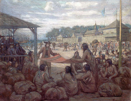
-
Collection
Fur Trade in Canada
The fur trade was a vast commercial enterprise across the wild, forested expanse of what is now Canada. It was at its peak for nearly 250 years, from the early 17th to the mid-19th centuries. It was sustained primarily by the trapping of beavers to satisfy the European demand for felt hats. The intensely competitive trade opened the continent to exploration and settlement. It financed missionary work, established social, economic and colonial relationships between Europeans...
"https://d3d0lqu00lnqvz.cloudfront.net/media/media/e4ec1e55-01c2-4b77-a220-f05a84fd4c9c.jpg" // resources/views/front/categories/view.blade.php
https://d3d0lqu00lnqvz.cloudfront.net/media/media/e4ec1e55-01c2-4b77-a220-f05a84fd4c9c.jpg
-
Article
Fur Trade Route Networks
Throughout the period of the historical fur trade (early 17th to the mid-19th century), water routes were the natural “highways” of First Nations trappers and European fur traders. Water trading networks connected Indigenous societies from the Atlantic Ocean, along the St. Lawrence River to the Great Lakes, and then on towards the Hudson Bay watershed. North America’s waterborne geography facilitated intracontinental travel, enabled European expansion and settlement into Indigenous North America, and shaped the contours of Euro-Indigenous relations in the context of the fur trade. These extensive and interconnected systems of rivers, lakes and overland trails criss-crossed Indigenous territories and had been used for generations. At the height of the fur trade, the principal canoe route extended westward from the Island of Montreal through the Great Lakes, and from the northwestern shore of Lake Superior over the height of land into the Hudson Bay watershed. From the Lake Winnipeg basin, Indigenous trappers and European traders fanned out towards the Western Prairies via the Assiniboine, Qu’Appelle and Souris rivers, towards the foothills of the Rocky Mountains via the North and South branches of the Saskatchewan River, and finally towards the Athabasca Country via the Sturgeon-weir River and the Methye Portage.
"https://d3d0lqu00lnqvz.cloudfront.net/media/media/6a52818a-3f78-427a-a201-5e6bc9c5d874.jpg" // resources/views/front/categories/view.blade.php
https://d3d0lqu00lnqvz.cloudfront.net/media/media/6a52818a-3f78-427a-a201-5e6bc9c5d874.jpg
-
Article
Garrison Mentality
Garrison mentality is a concept in Canadian literary theory and criticism. It was first put forth by critic and scholar Northrop Frye in the mid-1960s. It argues that early Canadian identity was shaped by the fear of a hostile landscape. Communities had to defend themselves from overwhelming forces. Frye believed that the threat of Canada’s wilderness — a “huge, unthinking, menacing, and formidable physical setting” — led to a desire among Canadians to retreat into safety. This in turn shaped their values as a group. Frye argued that the environment’s impact on Canada’s national psyche was revealed through recurring themes in Canadian art and culture. As a literary theory, the garrison mentality has inspired both supporters and detractors. Frye argued that it could be a limiting factor in the development of the arts in Canada. Others have argued that the mentality has merit, and that it resists the hyper-individualism of modern life.
"https://d3d0lqu00lnqvz.cloudfront.net/media/media/b92b7c2b-030a-4e8b-a2d8-11b69cff66a6.jpg" // resources/views/front/categories/view.blade.php
https://d3d0lqu00lnqvz.cloudfront.net/media/media/b92b7c2b-030a-4e8b-a2d8-11b69cff66a6.jpg
-
Article
Genocide
Genocide is the intentional destruction of a particular group through killing, serious physical or mental harm, preventing births and/or forcibly transferring children to another group. The Canadian government has formally recognized certain instances of genocide abroad, including the Armenian genocide, the Holodomor, the Holocaust, the Rwandan genocide, the ethnic cleansing in Bosnia, the Uyghur genocide and the Rohingya genocide. Within Canada, some historians, legal scholars and activists have claimed that the historical, intergenerational and present treatment of Indigenous peoples are acts of genocide.
"https://d3d0lqu00lnqvz.cloudfront.net/media/media/1f69f381-4d3b-489f-aba6-0a7dd06d3e92.jpg" // resources/views/front/categories/view.blade.php
https://d3d0lqu00lnqvz.cloudfront.net/media/media/1f69f381-4d3b-489f-aba6-0a7dd06d3e92.jpg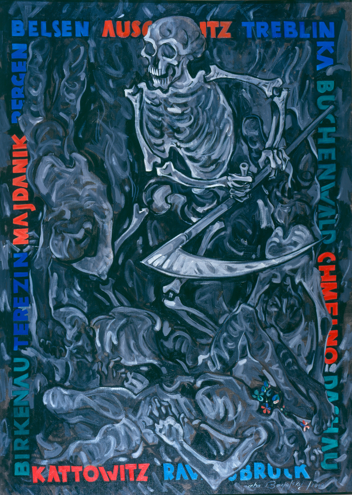
-
Article
Geological Survey of Canada
The Geological Survey of Canada (GSC) is Canada's national agency for geoscientific information and research. It studies and reports on Canada’s geology, natural geological hazards, and the development of natural resources. Established in 1842 primarily to promote the mining industry, it is one of the country’s oldest scientific organizations. Throughout its history, the Survey has produced some of the most comprehensive and detailed maps of the Canadian landscape, and published several important reports on its ecology and natural history.
"https://d3d0lqu00lnqvz.cloudfront.net/media/media/2bebe9b8-7dbd-4569-9cc1-fb24d96fa6de.jpg" // resources/views/front/categories/view.blade.php
https://d3d0lqu00lnqvz.cloudfront.net/media/media/2bebe9b8-7dbd-4569-9cc1-fb24d96fa6de.jpg
-
Editorial
Editorial: Newfoundland’s Contribution to the Patriation of the Constitution
The following article is an editorial written by The Canadian Encyclopedia staff. Editorials are not usually updated. In the decades since 1982, politicians and the media have recounted the same story about the patriation of Canada’s constitution and the adoption of the Charter of Rights and Freedoms. Most of the credit in this version goes to Prime Minister Pierre Trudeau. Three others are credited with breaking an impasse in the 1981 negotiations: federal justice minister Jean Chrétien, Saskatchewan attorney general Roy Romanow, and Ontario attorney general Roy McMurtry. But in his memoirs, former Newfoundland Premier Brian Peckford argues that the key intervention in the patriation process came from Peckford and the members of the Newfoundland delegation.
"https://d3d0lqu00lnqvz.cloudfront.net/media/media/0bc62d4c-deea-4509-8390-d8fa47d7c99a.jpg" // resources/views/front/categories/view.blade.php
https://d3d0lqu00lnqvz.cloudfront.net/media/media/0bc62d4c-deea-4509-8390-d8fa47d7c99a.jpg
-
Article
Ned McGowan, Hill's Bar and the Fraser River Gold Rush
For one brief historical moment in 1858, the most important spot in British Columbia was a gravel bed in the Fraser River about two kilometres south of Yale. It was only 45 metres long when the river was low (and invisible when the water rose). It was called Hill's Bar.
"https://d3d0lqu00lnqvz.cloudfront.net/media/media/61990303-ef91-4022-ba1b-3e495ea9a6d5.jpg" // resources/views/front/categories/view.blade.php
https://d3d0lqu00lnqvz.cloudfront.net/media/media/61990303-ef91-4022-ba1b-3e495ea9a6d5.jpg