
Browse "Places"
-
Article
Acton Vale
Known as La porte de l'Estrie (Door to the Eastern Townships), Acton Vale is the county seat of the regional municipality of Acton. Its main employer is Peerless Carpets. The town's cultural life is centered on the old Grand Trunk railway station, now a tourist information bureau and art gallery. The river winds through the town offering green spaces and cycling paths.
"https://d3d0lqu00lnqvz.cloudfront.net/media/media/ace2f98d-2bc0-4992-a7c8-e67a7f9fffdc.jpg" // resources/views/front/categories/view.blade.php
https://d3d0lqu00lnqvz.cloudfront.net/media/media/ace2f98d-2bc0-4992-a7c8-e67a7f9fffdc.jpg
-
Article
Africville
Africville was a Black Canadian village located just north of Halifax, Nova Scotia and founded around the mid-19th century. The City of Halifax demolished the once-prosperous seaside community in the 1960s in what many said was an act of racism. The mayor of the Halifax Regional Municipality apologized for the action in 2010. For many people, Africville represents the oppression faced by Black Canadians, and the efforts to right historic wrongs. In 2024, Africville was designated Canada’s first UNESCO Place of History and Memory linked to enslavement and the slave trade.
"https://d3d0lqu00lnqvz.cloudfront.net/media/media/Africville.jpeg" // resources/views/front/categories/view.blade.php
https://d3d0lqu00lnqvz.cloudfront.net/media/media/Africville.jpeg
-
Article
Agawa Pictograph Site
The cliff is on a big rock of white crystalline granite, which contrasts with the red paintings although mineral traces, lichens and graffiti have damaged them in some places.
"https://d3d0lqu00lnqvz.cloudfront.net/media/media/71281b2f-b349-43f2-aa64-81e3ee6e2e28.jpg" // resources/views/front/categories/view.blade.php
https://d3d0lqu00lnqvz.cloudfront.net/media/media/71281b2f-b349-43f2-aa64-81e3ee6e2e28.jpg
-
Article
Agnes Etherington Art Centre
The Agnes Etherington Art Centre, located in Kingston, Ont, is the legacy of Agnes Richardson Etherington (1880-1954) who left her 19th-century Georgian-style house to Queen's University to be used as a permanent art facility for the community.
"https://thecanadianencyclopedia.ca/images/tce_placeholder.jpg?v=e9dca980c9bdb3aa11e832e7ea94f5d9" // resources/views/front/categories/view.blade.php
https://thecanadianencyclopedia.ca/images/tce_placeholder.jpg?v=e9dca980c9bdb3aa11e832e7ea94f5d9
-
Article
Airdrie
Airdrie, AB, incorporated as a city in 1985, population 61,581 (2016 census), 42,564 (2011 census).
"https://thecanadianencyclopedia.ca/images/tce_placeholder.jpg?v=e9dca980c9bdb3aa11e832e7ea94f5d9" // resources/views/front/categories/view.blade.php
https://thecanadianencyclopedia.ca/images/tce_placeholder.jpg?v=e9dca980c9bdb3aa11e832e7ea94f5d9
-
Article
Airport Architecture
A new wave of construction was inspired by the formation of the Department of Transport in 1937 and the inauguration of Trans-Canada Airlines (now Air Canada) in 1937. Dorval Airport (1940-41) near Montréal represented the new breed of airports.
"https://d3d0lqu00lnqvz.cloudfront.net/media/media/77f3aa71-9379-44cd-adc9-36aeaee8f6c7.jpg" // resources/views/front/categories/view.blade.php
https://d3d0lqu00lnqvz.cloudfront.net/media/media/77f3aa71-9379-44cd-adc9-36aeaee8f6c7.jpg
-
Article
Ajax
Ajax, Ontario, incorporated as a town in 1955, population 119,677 (2016 census), 109,600 (2011 census). The town of Ajax is located 13 km from the eastern boundary of Toronto on the north shore of Lake Ontario. Ajax became part of the Regional Municipality of Durham in October 1973. In January 1974, Ajax expanded to include the village of Pickering (incorporated 1953) and part of Pickering Township.
"https://d3d0lqu00lnqvz.cloudfront.net/media/new_article_images/Ajax/Ajax.jpg" // resources/views/front/categories/view.blade.php
https://d3d0lqu00lnqvz.cloudfront.net/media/new_article_images/Ajax/Ajax.jpg
-
Article
Akami-Uapishkᵁ-KakKasuak-Mealy Mountains National Park Reserve
Akami-Uapishkᵁ-KakKasuak-Mealy Mountains National Park Reserve in Newfoundland and Labrador is the largest national park in eastern Canada, spanning 10,700 km2 along the eastern coast of Labrador. Designated as the 46th national park on 31 July 2015, this park houses boreal forest, marine habitat, mountain terrain and an abundance of unique species. The conservation and management of the park is shared by the Indigenous communities who call these lands home: the Innu Nation, the Nunatsiavut Government, the NunatuKavut Community Council and the Innu of Quebec.
"https://d3d0lqu00lnqvz.cloudfront.net/mealymountainsnationalparkreserve/Mealy_Mountains_Labrador_3.jpg" // resources/views/front/categories/view.blade.php
https://d3d0lqu00lnqvz.cloudfront.net/mealymountainsnationalparkreserve/Mealy_Mountains_Labrador_3.jpg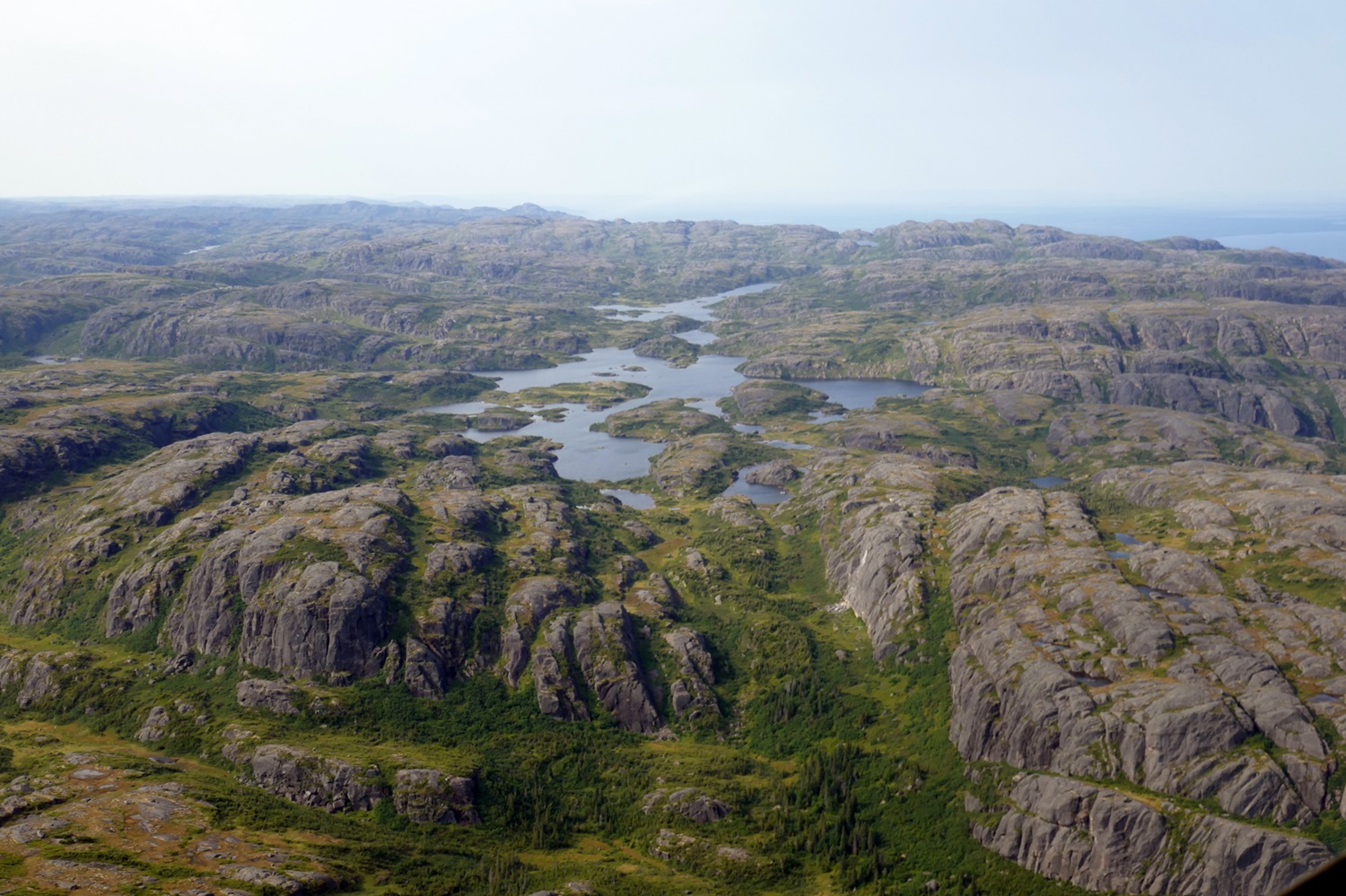
-
Article
Aklavik
Aklavik, NWT, incorporated as a hamlet in 1974, population 536 (2021 census), 590 (2015 census). The Hamlet of Aklavik is located near the mouth of the Mackenzie River, 1143 air km northwest of Yellowknife.
"https://d3d0lqu00lnqvz.cloudfront.net/Aklavik/Aklavik-2006.jpg" // resources/views/front/categories/view.blade.php
https://d3d0lqu00lnqvz.cloudfront.net/Aklavik/Aklavik-2006.jpg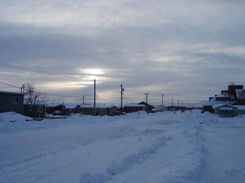
-
Article
Alaska Highway
The Alaska Highway was constructed from 1942 to 1943 during the Second World War. It went from Dawson Creek, British Columbia to Alaska.
"https://d3d0lqu00lnqvz.cloudfront.net/media/media/a05d65be-42fb-40dd-8b0f-a3a3f4b44506.jpg" // resources/views/front/categories/view.blade.php
https://d3d0lqu00lnqvz.cloudfront.net/media/media/a05d65be-42fb-40dd-8b0f-a3a3f4b44506.jpg
-
"https://thecanadianencyclopedia.ca/images/tce_placeholder.jpg?v=e9dca980c9bdb3aa11e832e7ea94f5d9" // resources/views/front/categories/view.blade.php
https://thecanadianencyclopedia.ca/images/tce_placeholder.jpg?v=e9dca980c9bdb3aa11e832e7ea94f5d9
-
Article
Alberta
Alberta, the westernmost of Canada's three Prairie provinces, shares many physical features with its neighbours to the east, Saskatchewan and Manitoba. The Rocky Mountains form the southern portion of Alberta's western boundary with British Columbia. Alberta was named after Princess Louise Caroline Alberta, fourth daughter of Queen Victoria. The province is home to the country’s largest deposits of oil and natural gas.
"https://d3d0lqu00lnqvz.cloudfront.net/media/media/251b5d36-82cc-4ec1-80e8-471cfd59098a.jpg" // resources/views/front/categories/view.blade.php
https://d3d0lqu00lnqvz.cloudfront.net/media/media/251b5d36-82cc-4ec1-80e8-471cfd59098a.jpg
-
Timelines
Alberta
Alberta, the westernmost of Canada's three Prairie provinces, shares many physical features with its neighbours to the east, Saskatchewan and Manitoba. The Rocky Mountains form the southern portion of Alberta's western boundary with British Columbia.
"https://d3d0lqu00lnqvz.cloudfront.net/media/media/412a21a2-aed2-4825-9e29-83935aa5961e.jpg" // resources/views/front/categories/view.blade.php
https://d3d0lqu00lnqvz.cloudfront.net/media/media/412a21a2-aed2-4825-9e29-83935aa5961e.jpg
-
Article
Alberta Hilda Dinosaur Mega-Bonebed
The Hilda mega-bonebed in southern Alberta is one of the largest dinosaur bonebeds in the world and the largest in Canada. It is made up of a group of at least 14 discontinuous bonebeds that occur in a mudstone deposit exposed along the South Saskatchewan River west of Hilda. It is estimated that the mega-bonebed contains the remains of a few thousand individuals of the cow-size dinosaur, Centrosaurus apertus. Although the mega-bonebed covers an area of at least 2.3 square kilometres on either side of the South Saskatchewan River valley, the discontinuous bonebeds that make up the mega-bonebed cover only hundreds to a few thousands of square metres each. The site is important because it confirms that Centrosaurus was a herding dinosaur, and documents that the herds were larger than previously thought, numbering well into the thousands. When combined with data from Dinosaur Provincial Park, located 100 km west of Hilda, data from the mega-bonebed also suggest that Centrosaurus migrated annually in an east-west direction, toward or away from the interior seaway that occupied the centre of North America at that time.
"https://d3d0lqu00lnqvz.cloudfront.net/media/media/02a642a0-0d77-4886-9c75-55a389c9b77a.jpg" // resources/views/front/categories/view.blade.php
https://d3d0lqu00lnqvz.cloudfront.net/media/media/02a642a0-0d77-4886-9c75-55a389c9b77a.jpg
-
Article
Alberta Jubilee Auditoriums
Alberta Jubilee Auditoriums, Northern (Edmonton) and Southern (Calgary). Built between 1955 and 1957 as a memorial to Alberta's pioneers.
"https://thecanadianencyclopedia.ca/images/tce_placeholder.jpg?v=e9dca980c9bdb3aa11e832e7ea94f5d9" // resources/views/front/categories/view.blade.php
https://thecanadianencyclopedia.ca/images/tce_placeholder.jpg?v=e9dca980c9bdb3aa11e832e7ea94f5d9