Share on Facebook
 Share on X
 Share by Email
 Share on Google Classroom
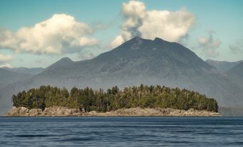
Nakusp, British Columbia, incorporated as a village in 1964, population 1,605 (2016 census), 1,569 (2011 census). The village of Nakusp is located on the east shore of Upper Arrow Lake at the foot of the Selkirk Mountains. It is in the West Kootenay district of south-eastern British Columbia. Nakusp is located on the traditional territory of the Sinixt, Ktunaxa,
Secwepemc and Okanagan peoples. (See also Interior Salish.) The name is derived from a Sinixt word,
though its meaning is debated. One interpretation is that the name Nakusp comes from a word meaning “the bay behind the long point,” another is that it means, “closed-in” or “safe.”
Settlement and Development
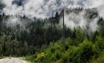
The region was settled during the Slocan Valley mining boom of the 1890s and early 1900s. Settlers also engaged in mixed farming and a prosperous lumber industry. Nakusp was established in 1893 as the western terminus of the Nakusp and Slocan Railway. It was an important landing for the various paddlewheel steamboats that served the industries and settlers along the Arrow Lakes until the 1950s. After that, the village and area went into some decline. Today, the forest industry and tourism are important economic drivers. The nearby Nakusp Hot Springs, owned by the village, is open year-round.