Share on Facebook
 Share on X
 Share by Email
 Share on Google Classroom

Early Uses of the Name “Canada”
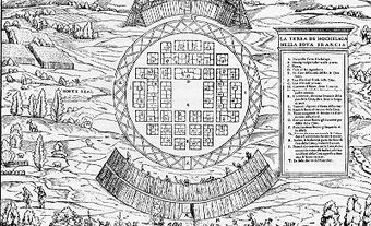
Jacques Cartier referred to the St. Lawrence as the “rivière de Canada” and the name was in general use until the end of the century. But on 10 August 1535 he had given the name Saint Laurent to a bay north of Île d'Anticosti, and the name spread gradually to the gulf and river. In 1603, on his first voyage to Canada, Samuel de Champlain spoke of the “river of Canada,” but by 1613 used Saint Laurent for the gulf. The name Canada was used loosely, even in official correspondence, as a synonym for New France, which included all French possessions. However, it was always understood, as Father Pierre Biard pointed out in the Jesuit Relation for 1616, that “Canada…is not, properly speaking, all this extent of country which they now call New France; but it is only that part, which extends along the banks of the great River Canada, and the Gulf of St. Lawrence.” In 1664 François Du Creux, in his work Historia Canadensis, drew the same distinction.
Conquest of New France
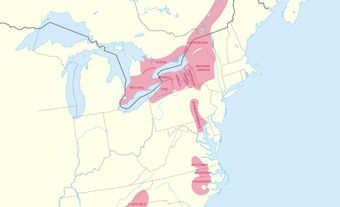
As French explorers and fur traders pushed ever westward and southward, the area to which the name “Canada” applied increased rapidly. However, its extent seems never to have been defined officially. In March 1762, after the Conquest of New France, General Thomas Gage informed General Jeffery Amherst that the limits between Canada and Louisiana had never been clearly described. He could only state “what were generally believed... to have been the Boundaries of Canada & give you my own Opinion.” He judged “not only the [Great] Lakes, which are Indisputable, but the whole Course of the Mississippi from its Heads to its Junction with the Illinois” had been considered by the French to be part of Canada. This may be one reason why Britain temporarily abandoned the name and called the colony the Province of Quebec.
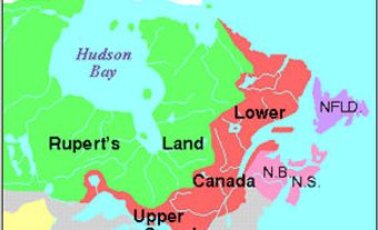
Constitutional Act–Confederation
Canada came into its own in 1791 when the Constitutional Act (or Canada Act) divided the Province of Quebec, then considerably enlarged, into the provinces of Upper Canada and Lower Canada. In 1841 they were joined to form the Province of Canada. In 1867 the British North America Act united the Province of Canada (divided into Ontario and Quebec) with Nova Scotia and New Brunswick to form “One Dominion under the name of Canada.” The new area was relatively small, but it expanded rapidly. The purchase of Rupert’s Land in 1870 extended it to the Rocky Mountains and the Arctic Ocean. The addition of British Columbia in 1871 created a Canada extending from sea to sea; Prince Edward Island was added in 1873 and Britain handed over title to the Arctic islands in 1880. This gave Canada substantially the present boundaries, except for Newfoundland and Labrador, which joined the federation in 1949. In a striking comment, the distinguished American historian Samuel Eliot Morison remarked that “never, since the Roman empire, have two local names received such a vast extension as Canada and St. Lawrence.” (See also Exploration; Territorial Evolution.)