Share on Facebook
 Share on X
 Share by Email
 Share on Google Classroom
Geography
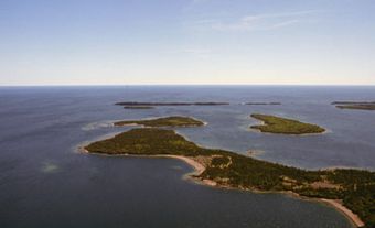
Lake Winnipeg’s drainage basin extends from the foothills of the Rocky Mountains across Alberta, Saskatchewan and Manitoba to the rolling metamorphic uplands of Ontario's Precambrian shield. In the south it extends along the Red River to the headwaters of the Mississippi, including large parts of the states of Minnesota and North Dakota. Lake Winnipeg discharges its waters into the Nelson River, which flows to Hudson Bay at an average annual rate of 2,066 m 3/s.
On long and relatively narrow lakes such as Lake Winnipeg, interesting wind and wave effects occasionally take place. When prevailing northerly winds blow along the length of Lake Winnipeg, they exert a horizontal stress on its surface. Surface waters move in the direction of the wind and pile up along the windward south shores — a phenomenon known as a setup or wind tide. Setups greater than 1 m above normal lake levels have been recorded along many of southern Lake Winnipeg’s recreational beaches, and the associated high waves with their uprush effects have caused considerable storm damage, backshore flooding and shoreline erosion. The highest setups occur in the fall, when the northerly winds are strongest. If the winds die down suddenly, the waters rush northward, then slosh back and forth in a process called seiching.
Geology
The lake lies in a lowland basin that was scoured out of the limestone and shale bedrock by continental glaciers during the ice ages. When the glaciers finally melted, about 12,000 years ago, a large glacial lake, Lake Agassiz, filled the entire basin. It gradually drained and exposed a flat plain that extends from the Manitoba Escarpment in the west to the rocky edge of the Precambrian Shield in the east. Today the glacial lake bottom constitutes the Manitoba Lowlands and is occupied by lakes Winnipeg, Winnipegosis and Manitoba.
History
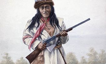
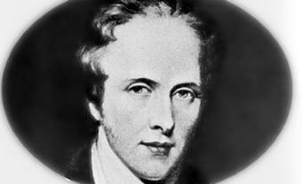
The Cree called Lake Winnipeg win nipee meaning “muddy water.” English explorer Henry Kelsey (1690) may have been the first European to see the lake. The lake soon became an important transport link between the Hudson Bay port of York Factory and the fur-trade hinterlands of the Red-Assiniboine watershed. In 1812, Lord Selkirk’s boats traversed the length of Lake Winnipeg on their way to founding the Red River Colony at the junction of the Red and Assiniboine rivers. Later the lake gave its name to this community, which became the capital of the new province of Manitoba. (See also Largest Cities in Canada With an Indigenous Name.)