Share on Facebook
 Share on X
 Share by Email
 Share on Google Classroom


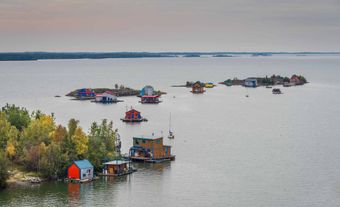
Lake Athabasca is located in northeastern Alberta and northwestern Saskatchewan, at the edge of the Precambrian Shield. With an area of 7,935 km2 and a 2,140 km shoreline, it is the eighth-largest lake in Canada. It has an elevation of 213 m, a maximum depth of 124 m and a mean depth of 20 m. The lake is fed by the Athabasca and Peace rivers and drains north via the Slave River into Great Slave Lake. Approximately 70 per cent of Lake Athabasca lies within Saskatchewan and the remainder in Alberta.
Ecology
Flora and Fauna
Lake Athabasca has had a commercial fishery since 1926, with a catch composed of primarily lake trout, northern pike and walleye. Other fish species documented in the lake include: lake whitefish, artic grayling, yellow perch, burbot, white sucker and longnose sucker.
On a larger scale, the lake is part of the Peace-Athabasca Delta, a biologically diverse wetland west of the lake and about the size of Prince Edward Island. It is an important migration point and nesting area for such bird species as the whooping crane, whistling swan as well as various geese and ducks. In addition, 80 per cent of the delta falls within the boundaries of Wood Buffalo National Park, a UNESCO world heritage site and sanctuary for the largest wild bison herd in North America.
Environmental Concerns
Lake Athabasca’s proximity to oil sands development is a primary cause of environmental concern. Prior to 1997 and the establishment of the Regional Aquatics Monitoring Program (RAMP), the effects of the oil sands on aquatic ecosystems were not monitored. In addition, RAMP’s effectiveness is often called into question, as the organization is funded by oil companies and has done poorly on scientific reviews.
Despite these challenges to data collection, recent studies show a direct correlation between the oil sands and increased pollution in Lake Athabasca. For example, a 2010 study revealed an increase in priority pollutants (i.e. elements named by the US Environmental Protection Agency’s Clean Water Act) to the Athabasca River and its tributaries. Similarly, a 2013 study demonstrated an increase in polycyclic aromatic hydrocarbons (PAHs) in lake ecosystems in the Athabasca oil sands region. PAHs are groupings of chemicals caused when fossil fuels and biomass are incompletely burned. They are of concern because they stay in the environment for long periods of time and do not break down easily in water. Much attention was brought to the possible results of these pollutants when, in 2010, scientists at the University of Alberta showed the public deformed fish caught in water around the oil sands, including Lake Athabasca.
History
The name Athabasca comes from the Cree word for the lake, athapiscow, describing an open area (such as a lake or swamp) where reeds, willows and grasses grow. In addition to the Cree, Beaver and Chipewyan First Nations have lived in the area for more than 2,000 years.
The lake was a pivotal point in the fur trade system, being as far west as canoes could go and still return before the ice. Peter Pond, an American fur trader, was responsible for starting business in the region in 1778. Fort Chipewyan (est 1788) was the meeting point, and is still a centre of trade. Camsell Portage, Uranium City and Eldorado are on or near the northern shore.