Share on Facebook
 Share on X
 Share by Email
 Share on Google Classroom
Settlement
Indigenous Peoples
While there is evidence of Indigenous contact with the area in the Archaic Period (7000–1000 BCE), archaeological evidence suggests settlement between 1000 BCE and 500 CE. After 500 CE, the Huron-Wendat and Haudenosaunee (Iroquois) occupied the eastern end of the Great Lakes, before the Haudenosaunee took control of the region in the mid-1600s. While European disease affected all Indigenous peoples, the Huron-Wendat were particularly affected by the smallpox epidemics between 1634 and 1640. These epidemics, combined with Haudenosaunee raids, weakened the Huron-Wendat population. By 1649 the area was largely controlled by the Haudenosaunee. Some Huron-Wendat went west, while others became a part of the Haudenosaunee confederacy.
In the 1690s, the Haudenosaunee began to be replaced by the Ojibwa (Mississauga) people who, by the 18th century, had moved along the Frontenac Axis of the Canadian Shield from the upper Great Lakes. Today, Mississauga live both on and off reserves, two of which are located in Alderville, Ontario, about 150 km west of Kingston (see Reserves in Ontario). The Alderville First Nation maintains a close relationship with the city. In terms of Kingston itself, as of 2016, Indigenous people made up 3.5 per cent of the city’s population.
European Settlement
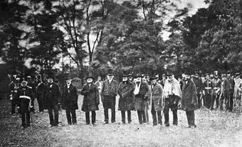
Samuel de Champlain explored the region in 1615; Louis de Buade, Comte de Frontenac established a fortified settlement (Cataraqui) in 1673; and René-Robert Cavalier La Salle developed Fort Frontenac there. It served as a fortification against the Haudenosaunee and British, and as a base for explorations to the west along the Great Lakes and to the south to the Gulf of Mexico (Louisiana). In 1758, the British captured the fort and, in 1763, the region was ceded to them by the Treaty of Paris.

(courtesy Library and Archives Canada/C-1511)
In 1783, following the American Revolution (War of Independence), the Crown acquired lands from the Mississauga through the Crawford Purchase (1783–84) to settle refugees from the former American colonies who were loyal to Britain at Cataraqui. The central settlement was named “King's Town” in honour of King George III. It became the administrative centre of the new district (Mecklenburg) consisting of townships fronting on the upper St. Lawrence River and eastern end of Lake Ontario.
Development
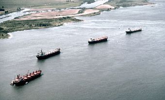
Located at the junction of the Great Lakes and the St. Lawrence River, Kingston developed into a major port because of its role as a point of trans-shipment for outgoing lumber and wheat, and for incoming merchandise and passengers. However, Kingston was considered vulnerable to attacks from the US; therefore, Lieutenant-Governor John Graves Simcoe first selected Newark (now Niagara-On-the-Lake), and later York (now Toronto), as the capital of the Province of Upper Canada.

(courtesy John Ross Robertson Coll/Metropolitan Toronto Library)
The War of 1812 resulted in a significant military and naval presence at Kingston, and stimulated the local economy and population growth. In 1832, the completion of the Rideau Canal linked Upper and Lower Canada by the Ottawa River–Rideau Lakes–Cataraqui River. This route bypassed the vulnerable St. Lawrence and terminated at the well-fortified Kingston. This development reinforced Kingston’s commercial function and the recognition of its strategic significance. Kingston initially became the largest town in Upper Canada, and was the capital of the new Province of Canada from 1841 until December 1843, when Queen Victoria approved the removal of the seat of government to Montreal.
Kingston’s economic fortunes at mid-century were affected by the decline in its trans-shipment role due to several factors: the termination of preferential trade (Corn Laws) with Britain; navigation improvements along the St. Lawrence allowed more through traffic to bypass Kingston; the arrival of the Grand Trunk Railway in 1856 presented a competitor to water transport; and larger lake vessels posed problems for Kingston’s harbour. The departure of the imperial garrison in 1871 dealt Kingston another economic blow.
Throughout the second half of the 19th century, lacking productive agricultural land and failing to attract industry, Kingston's economic fortunes and demographic growth fell behind other urban centres.
Despite municipal bonuses and tax relief, Kingston could not attract significant capital investment in industrial ventures. Although some textile factories and mineral refineries were added in the 1880s, the city's economy continued to be dominated by commerce and industries such as the locomotive works and shipyards.
Not until the Second World War did several new industries (e.g. Alcan Aluminium, DuPont Nylon) enter the city's regional economy. At the same time the established industries were also rejuvenated, as the shipyards began to make naval vessels and the locomotive works made weapons for the war. Following the post-war decline and closure of these industries, Kingston did not grow demographically. However, the absence of heavy industry and a large population, combined with its lakeside location and significant historical heritage have contributed to the quality of life and essence of Kingston.
Cityscape
The Kingston townscape retains much of the ambience of a 19th-century commercial-institutional town. As in the original town plot of 1783, Kingston's downtown continues to be focused on the few blocks fronting the waterfront between Princess and Brock, and Barrie and Ontario streets. In reaction to a fire (1840) that devastated much of the downtown, legislation prohibited wood construction and favoured the stone and brick that led to the name “limestone city.” Kingston is home to the Rideau Canal UNESCO World Heritage Site, and is adjacent to the UNESCO Frontenac Arch Biosphere.
Landmarks such as the City Hall, Customs House, Post Office and Murney Tower also reflected the city’s history. The renamed “Springer Market Square” has displaced former parking lots, retained its marketplace role, and added winter skating and summer movies. The distinctive church steeple skyscape of spires, towers and domes is maintained by St. George's (Anglican), St. Andrew's (Presbyterian), St. Mary's (Catholic) and Sydenham (United) churches that have adapted to declining congregations by providing tours, concerts and rental space for various community services. Other buildings have been converted in order to preserve heritage structures, including the Kingston Fire Hall (now a restaurant), the Kingston and Pembroke Railway Station (now a tourist office) and the historic Woolen Mill (now a restaurant and office space).
Since 1945, the major features of Kingston’s moderate urban growth have been a stable urban core and suburbanization. The principal expansion in the 1960s and 1970s was to the west in Kingston Township and Ernestown Township (in such communities as La Salle Park, Bayridge, Collins Bay and Amherstview), and to the east in Pittsburgh Township in the 1980s and 1990s. This prompted a decline in downtown retail outlets and the growth of suburban shopping malls in the 1960s and 1970s. This period also witnessed the first signs of downtown revitalization marked by the introduction of condominiums, rental properties, hotels, restaurants and boutiques, initially on former shipping and industrial sites on the waterfront.
Population
Kingston’s economic failure in the 19th century prevented its demographic growth at the same rate as other large Ontario communities such as Toronto, Hamilton and Ottawa, and it even experienced some periods of population decline. From a permanent population of about 2,000 just after the War of 1812, the city grew to almost 12,000 by mid-century and only to 14,000 by 1881. With a mere 30,000 in 1941, the city’s population expanded in subsequent decades due to annexations. In 1952, the expansion of the municipal boundaries to the west and north was associated with an increase to over 48,000 by 1956. Increasing slowly to about 60,000 in the late 1990s, the municipal population increased to over 110,000 in 1998 with the integration of Kingston Township and Pittsburgh Township into the city. As of 2021, Kingston’s population is 132,485.
Kingston was bypassed by the immigrants of the late 19th and early 20th centuries because of the lack of employment opportunities, and its population continued to be dominated by those of Anglo-Celtic origins. Today, the most commonly cited ethnic origin is Canadian, according to the 2016 census, at 35.5 per cent of the population, followed by English (32.2 per cent), Irish (27.8 per cent), Scottish (24.7 per cent), French (14.6 per cent) and German (10.5 per cent). Common countries of origin for immigrants to Kingston are the United Kingdom, the United States, Portugal, China and India.
Economy
In the period prior to the Second World War, Kingston's economy was dominated by the Canadian Locomotive Company, the Shipyards, Kingston Cotton Mills, and various small refineries and machine shops. During the war, the companies Alcan and DuPont were added to the Kingston region's industrial base, while Celanese Canada and Northern Telecom followed in the post-war years. However, by 2000, these latter four companies experienced a considerable overall reduction in their workforce and the institutional sector came to dominate the local economy.
Examples of Kingston’s institutional sector include the Royal Military College and the extensive military establishment at Barriefield. Similarly, the establishment of the penitentiary in 1835 by Upper Canada was followed by several other federal and provincial correctional institutions in Kingston and its environs (the Kingston Penitentiary closed in 2013).
The educational sector is another major employer. Queen's College at Kingston, originally a college of the Presbyterian Church in Canada, was founded in 1841, developed into Queen’s University with a national reputation, and is now a thriving presence. Finally, hospitals and other medical establishments, along with branch offices of government agencies, add to the institutional presence in Kingston.

Government and Politics
Following settlement in 1783, Kingston was governed according to the French laws of Quebec until the establishment of Upper Canada under the Constitutional Act, 1791. Justices of the peace and the Court of Quarter Sessions initially administered town affairs. Kingston was a “police town” until 1838, when it was incorporated as a municipality with a mayor, elected aldermen and councillors serving four wards. John A. Macdonald promoted Kingston’s incorporation as a city (1846). In 1850, Kingston extended its western limit to incorporate the village of Stuartville. In 1952, the city’s limits were again extended west to Little Cataraqui Creek and north to the present Highway 401. In 1998, the city’s regional dominance was recognized by the incorporation of the adjacent Kingston and Pittsburgh townships into the municipality. Following the amalgamations of 1952 and 1998, Kingston is now served by a mayor and councillor for each of its 12 districts.
Cultural Life
The military presence and Queen’s University have been major influences on Kingston’s artistic, theatrical and general culture. During the garrison years, military artists captured the townscape and region on their canvasses. These artists included James W. Peachey, Edward C. Frome, James P. Cockburn and Thomas Burrowes. Several other travelers or Kingston-based artists also became prominent, including Elizabeth Simcoe, Agnes Maule Machar, André-Charles Biéler, Carl F. Schaefer and Grant Macdonald. Those involved in the contemporary arts scene include Robert Blenderman, J. David Brown, Grace George and Shirley Gibson-Langille.
Prominent Canadian writers with a Kingston connection include Matt Cohen, Robertson Davies, Janette Turner Hospital, Helen Humphreys, Diane Schoemperlen and Bronwen Wallace.
Kingston’s formal cultural life includes a symphony orchestra and several local theatre groups. The Grand Theatre has long been a central cultural venue as Martin’s Opera House (1879–98), the Grand Opera House (1902 – 36), a movie theatre (1938–61) and in its current role as the home of the Kingston Symphony.
The Leon’s Centre (formerly Rogers K-Rock Centre) opened in 2008 as a sports and cultural facility. It is the home of the Kingston Frontenacs OHL ice hockey team, and has hosted curling and skating championships.
Kingston hosted the sailing competition in the 1976 Summer Olympics and Kingston Yacht Club holds the annual Canadian Olympic Regatta Kingston (CORK). Kingston’s back-country also attracts attention with the Frontenac Arch UNESCO Biosphere Reserve, the Cataraqui Trail and the Rideau Trail.