
Browse "Places"
-
Timelines
Nunavut
Nunavut, which translates from the Inuktitut dialect of the Eastern Arctic Inuit as "Our Land," is a Canadian territory.
"https://d3d0lqu00lnqvz.cloudfront.net/media/media/a4b74f70-c61f-4cfe-a857-0848e3cb40bd.jpg" // resources/views/front/categories/view.blade.php
https://d3d0lqu00lnqvz.cloudfront.net/media/media/a4b74f70-c61f-4cfe-a857-0848e3cb40bd.jpg
-
Article
Oak Bay
Oak Bay, incorporated as a district municipality in 1906, population 18 015 (2011c), 17 908 (2006c). The District of Oak Bay is located on the southeast corner of VANCOUVER ISLAND, adjoining the city of VICTORIA. It is surrounded by JUAN DE FUCA STRAIT on the south and Haro Strait on the east.
"https://thecanadianencyclopedia.ca/images/tce_placeholder.jpg?v=e9dca980c9bdb3aa11e832e7ea94f5d9" // resources/views/front/categories/view.blade.php
https://thecanadianencyclopedia.ca/images/tce_placeholder.jpg?v=e9dca980c9bdb3aa11e832e7ea94f5d9
-
Article
Oak Island
Oak Island, one of over 300 islands in Mahone Bay on Nova Scotia's Atlantic coast, is about 1.6 km long and 0.8 km wide. Legend reputes it as the site of buried treasure, attributed to various pirates, including William Kidd, Henry Morgan, and Blackbeard, as well as to Inca refugees fleeing Spanish conquistadors in South America.
"https://d3d0lqu00lnqvz.cloudfront.net/media/media/9479fa1e-5ac5-437b-816f-da794aa5071d.jpg" // resources/views/front/categories/view.blade.php
https://d3d0lqu00lnqvz.cloudfront.net/media/media/9479fa1e-5ac5-437b-816f-da794aa5071d.jpg
-
Article
Oak Ridges Moraine
The Oak Ridges Moraine is a prominent landform in southwestern Ontario, part of the Great Lakes region's linear moraines and Ontario's Greenbelt. Situated north of Lake Ontario, the 160 km-long moraine was named for its once-abundant oak trees. As one of the region's few remaining green corridors, the moraine performs vital environmental functions, filtering drinking water and providing habitats for various species. In 2001, the Oak Ridges Moraine obtained conservation status from the provincial government of Ontario, protecting it from urban expansion.
"https://d3d0lqu00lnqvz.cloudfront.net/greenbelt/oak-ridges-moraine.jpg" // resources/views/front/categories/view.blade.php
https://d3d0lqu00lnqvz.cloudfront.net/greenbelt/oak-ridges-moraine.jpg
-
Article
Oakville
Oakville, Ontario, incorporated as a town in 1857, population 213,759 (2021 census), 193,832 (2016 census). Located in Halton Region, Oakville is west of Mississauga, south of Halton Hills and east of Burlington. The Township of Trafalgar, the Village of Bronte and the Town of Oakville merged in 1962, creating present-day Oakville. Throughout history, the Oakville area has been home to different Indigenous groups, namely the Neutral, Huron-Wendat, Haudenosaunee and Anishinaabeg, including the Mississauga. The land is covered by Treaty 14, also known as the Head of the Lake Purchase (see also Upper Canada Land Surrenders).
"https://d3d0lqu00lnqvz.cloudfront.net/media/new_article_images/Oakville/OakvilleHarbour.jpg" // resources/views/front/categories/view.blade.php
https://d3d0lqu00lnqvz.cloudfront.net/media/new_article_images/Oakville/OakvilleHarbour.jpg
-
Article
Music in Oakville
Town founded in 1825 on Sixteen Mile Creek at Lake Ontario, between Toronto and Hamilton. A regimental brass band was formed in 1866 by the 20th Halton Battalion Infantry but was supplanted in 1881 by the
"https://d3d0lqu00lnqvz.cloudfront.net/media/media/d350b818-d876-4180-a3fa-2968eac987d9.jpg" // resources/views/front/categories/view.blade.php
https://d3d0lqu00lnqvz.cloudfront.net/media/media/d350b818-d876-4180-a3fa-2968eac987d9.jpg
-
Article
Ocean
The world ocean and its marginal seas cover about 71 per cent of the Earth's surface. Its division into individual oceans and seas is largely arbitrary and has varied through the years. Historically, people referred to five oceans: Atlantic, Pacific, Indian, Arctic and Antarctic (or Southern). Modern convention speaks of only the first three: the Arctic is considered a marginal sea of the Atlantic; the Southern, the southern continuation of the Atlantic, Indian and Pacific oceans. Thus, Canada can be seen to be surrounded by two (Atlantic, Pacific) or three (Atlantic, Pacific, Arctic) oceans, depending on the scheme of division used.
"https://d3d0lqu00lnqvz.cloudfront.net/seiwhale/krill.jpg" // resources/views/front/categories/view.blade.php
https://d3d0lqu00lnqvz.cloudfront.net/seiwhale/krill.jpg
-
Article
Oil City
Oil City, Alberta, is the site of western Canada's first producing oil well, known previously as Original Discovery No 1, located in WATERTON LAKES NATIONAL PARK. Kutenai had used oil from seepage pools along Cameron Creek and early settlers used it to lubricate wagons.
"https://thecanadianencyclopedia.ca/images/tce_placeholder.jpg?v=e9dca980c9bdb3aa11e832e7ea94f5d9" // resources/views/front/categories/view.blade.php
https://thecanadianencyclopedia.ca/images/tce_placeholder.jpg?v=e9dca980c9bdb3aa11e832e7ea94f5d9
-
Article
Oka
Oka, Quebec, incorporated as a municipality in 1875, population 3,968 (2021 census), 3,824 (2016 census). Oka is located on Lac des Deux Montagnes, just west of Île de Montréal.
"https://d3d0lqu00lnqvz.cloudfront.net/media/media/af36926e-717c-45ef-91cc-f00a20c1faeb.jpg" // resources/views/front/categories/view.blade.php
https://d3d0lqu00lnqvz.cloudfront.net/media/media/af36926e-717c-45ef-91cc-f00a20c1faeb.jpg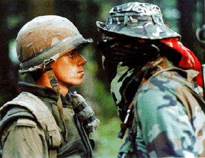
-
Article
Okak Archaeological Sites
The Okak Archaeological Sites in northern Labrador represent a microcosm of more than 5000 years of Prehistory of that region.
"https://thecanadianencyclopedia.ca/images/tce_placeholder.jpg?v=e9dca980c9bdb3aa11e832e7ea94f5d9" // resources/views/front/categories/view.blade.php
https://thecanadianencyclopedia.ca/images/tce_placeholder.jpg?v=e9dca980c9bdb3aa11e832e7ea94f5d9
-
Article
Okanagan Lake
Okanagan Lake is located in the southern interior of British Columbia and is the largest lake in the Okanagan Valley. Approximately 6,188 km2 of land drain into the lake, which has a total surface area of 351 km2. The lake is long and thin, measuring 120 km in length and ranging between 3 and 5 km in width. The depth of the lake is highly variable, with a mean depth of 76 m and a maximum depth of 230 m. Okanagan Lake is heavily used for recreation and is believed by some to be the home of the mythical Ogopogo creature.
"https://d3d0lqu00lnqvz.cloudfront.net/media/media/7683aa12-4190-4aca-ab28-5f9862bdad24.jpg" // resources/views/front/categories/view.blade.php
https://d3d0lqu00lnqvz.cloudfront.net/media/media/7683aa12-4190-4aca-ab28-5f9862bdad24.jpg
-
Article
Okanagan Valley
The Okanagan Valley is in south-central British Columbia, extending about 200 km north from the American border.
"https://d3d0lqu00lnqvz.cloudfront.net/media/media/4c55a3e5-810a-4ea3-b81d-24da77ff3b7c.jpg" // resources/views/front/categories/view.blade.php
https://d3d0lqu00lnqvz.cloudfront.net/media/media/4c55a3e5-810a-4ea3-b81d-24da77ff3b7c.jpg
-
Article
Okotoks
Okotoks, Alberta, incorporated as a town in 1904, population 30,214 (2021 census), 28,833 (2016 census). The town of Okotoks is located 20 km south of Calgary.
"https://d3d0lqu00lnqvz.cloudfront.net/media/media/3b6d7b08-6a6e-43bd-adc4-3966fa1a210c.jpg" // resources/views/front/categories/view.blade.php
https://d3d0lqu00lnqvz.cloudfront.net/media/media/3b6d7b08-6a6e-43bd-adc4-3966fa1a210c.jpg
-
Article
Old Crow
Old Crow, Yukon, settlement, population 236 (2021 census), 221 (2016 census). Old Crow is located in northern Yukon on the confluence of the Porcupine and Old Crow rivers, and 112 km inside the Arctic Circle.
"https://d3d0lqu00lnqvz.cloudfront.net/media/media/1c3c3ccd-a459-49b0-a70d-f148ef5d1716.jpg" // resources/views/front/categories/view.blade.php
https://d3d0lqu00lnqvz.cloudfront.net/media/media/1c3c3ccd-a459-49b0-a70d-f148ef5d1716.jpg
-
Article
Old Crow Basin
Old Crow Basin is an important geographic feature in the natural history and human history of Canada. It is the largest of four interior lowland areas within northern Yukon. Sediments washed into these basins built up deep deposits that buried and preserved the remains of many varieties of plants and animals, creating a fossil record locked in permafrost and spanning more than a million years.
"https://d3d0lqu00lnqvz.cloudfront.net/media/media/3372115f-2e5f-492c-a1d9-de73d4668939.jpg" // resources/views/front/categories/view.blade.php
https://d3d0lqu00lnqvz.cloudfront.net/media/media/3372115f-2e5f-492c-a1d9-de73d4668939.jpg