
Browse "Places"
-
Article
Metchosin
Metchosin, British Columbia, incorporated as a district municipality in 1984, population 4,708 (2016 census), 4,803 (2011 census). The District of Metchosin is located on Vancouver Island. It overlooks the Juan de Fuca Strait. Metchosin is part of the Greater Victoria area. From the late 1800s to 1958, a quarantine station operated at William Head in Metchosin. Many immigrants arriving to Canada by ship were quarantined at William Head before being allowed to enter the country. This was done in an effort to prevent the spread of infectious diseases common on overcrowded ships. In addition, from 1924 to 1956, there was a leper colony on nearby Bentinck Island.
"https://d3d0lqu00lnqvz.cloudfront.net/media/media/853b5d41-e9b6-4b2e-a205-03a54f80d5b2.jpg" // resources/views/front/categories/view.blade.php
https://d3d0lqu00lnqvz.cloudfront.net/media/media/853b5d41-e9b6-4b2e-a205-03a54f80d5b2.jpg
-
Article
Métis Experiences at Residential School
Although the first residential schools in Canada were established with the intention of assimilating First Nations children into Euro-Canadian culture, Métis and Inuit children were also institutionalized in such facilities. Métis children experienced similar day-to-day conditions to those of other students in residential schools, but they were often considered “outsiders” by their peers and administrators. This perception affected their experiences within these institutions in particular ways.
"https://d3d0lqu00lnqvz.cloudfront.net/MetisExperiences/Webp.net-resizeimage.jpg" // resources/views/front/categories/view.blade.php
https://d3d0lqu00lnqvz.cloudfront.net/MetisExperiences/Webp.net-resizeimage.jpg
-
Article
Métis Road Allowance Communities
Road allowance communities were home to Métis families throughout the late 1800s until the mid- to late 1900s. Métis peoples used the road allowances as new home communities after experiencing relocations, migrations and dispossession from their homelands. After resistance and violence in a period during and after the Riel Resistance of 1869–1870 and the North–West Resistance in 1885, Métis were marginalized and labelled as rebellious or troublesome by the government of Canada and the provinces.
"https://d3d0lqu00lnqvz.cloudfront.net/media/media/RoosterTownFamily.jpg" // resources/views/front/categories/view.blade.php
https://d3d0lqu00lnqvz.cloudfront.net/media/media/RoosterTownFamily.jpg
-
Article
History of Métis Settlements in Canada
Métis communities are found in many provinces and territories in Canada; however, the only legislated Métis land base is in Alberta. Eight Métis settlements are located across the northern and central-eastern part of the province: Paddle Prairie, Peavine, Gift Lake, East Prairie, Buffalo Lake, Kikino, Elizabeth and Fishing Lake. As of 2021, the settlements cover 1.25 million acres of land and are home to approximately 4,238 people. That year, 3,540 people reported that they were registered members of Métis Settlements in Alberta. The Métis Settlements are self-governing and provide for the protection of Métis culture and identity.
"https://d3d0lqu00lnqvz.cloudfront.net/MetisSettlementsFlag/Metis_Settlements_Flag.gif" // resources/views/front/categories/view.blade.php
https://d3d0lqu00lnqvz.cloudfront.net/MetisSettlementsFlag/Metis_Settlements_Flag.gif
-
Article
Metlakatla Pass Area
Metlakatla Pass, or Venn Passage, is located 4 km west of Prince Rupert on the northern BC coast.
"https://thecanadianencyclopedia.ca/images/tce_placeholder.jpg?v=e9dca980c9bdb3aa11e832e7ea94f5d9" // resources/views/front/categories/view.blade.php
https://thecanadianencyclopedia.ca/images/tce_placeholder.jpg?v=e9dca980c9bdb3aa11e832e7ea94f5d9
-
Article
Miawpukek First Nation
According to Mi’kmaw oral tradition, they have lived in their ancestral territory of Mi’kma’ki since time immemorial. Their descendants, the Mi’kmaq living throughout Mi’kma’ki today, include the Miawpukek First Nation and Qalipu Mi’kmaq First Nation in Ktaqmkuk (Newfoundland). There are other Mi’kmaw First Nations throughout Eastern Canada, along with the Mi’kmaq Nation Tribe in the United States. Miawpukek First Nation is one of two Mi’kmaw First Nations in Newfoundland (see First Nations in Newfoundland and Labrador). As of March 2026, Miawpukek First Nation had a registered population of 3,163 members, with 838 members living on its reserve.
"https://d3d0lqu00lnqvz.cloudfront.net/MiawpukekFirstNation/Miawpukek_First_Nation_resized.jpg" // resources/views/front/categories/view.blade.php
https://d3d0lqu00lnqvz.cloudfront.net/MiawpukekFirstNation/Miawpukek_First_Nation_resized.jpg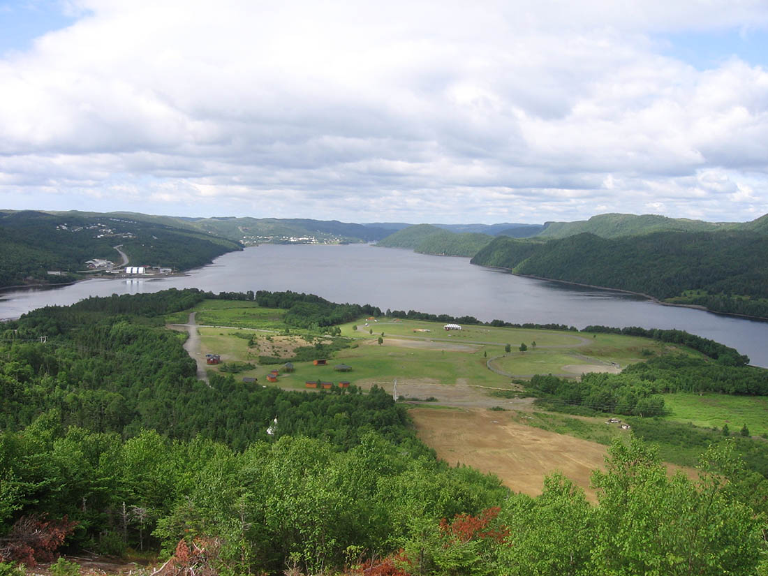
-
Article
Mica Bay Incident
In November 1849, a force of Anishinaabeg (see Ojibwe) and Métis warriors, led by Chiefs Oshawano, Shingwaukonse and Nebenaigoching, forced the Quebec and Lake Superior Mining Association to stop operating at Pointe aux Mines, Mica Bay, Lake Superior. Mica Bay is approximately 100 km northwest of Sault Ste. Marie (by road) on Lake Superior. The closure of the mine and the reaction of the Canada West authorities are known as the Mica Bay Incident.
"https://d3d0lqu00lnqvz.cloudfront.net/media/new_article_images/MicaBayIncident/Mica_Bay_c1850.jpg" // resources/views/front/categories/view.blade.php
https://d3d0lqu00lnqvz.cloudfront.net/media/new_article_images/MicaBayIncident/Mica_Bay_c1850.jpg
-
Article
Middleton
Middleton, NS, incorporated as a town in 1909, population 1749 (2011c), 1829 (2006c). The Town of Middleton is located in Nova Scotia's historic ANNAPOLIS VALLEY.
"https://d3d0lqu00lnqvz.cloudfront.net/media/media/bcfd90ed-d214-45b6-8e09-5896fdf32004.jpg" // resources/views/front/categories/view.blade.php
https://d3d0lqu00lnqvz.cloudfront.net/media/media/bcfd90ed-d214-45b6-8e09-5896fdf32004.jpg
-
Article
Midland
Midland, Ont, incorporated as a town in 1890, population 16 572 (2011c), 16 330 (2006c). The Town of Midland is located on Midland Bay, an inlet of Georgian Bay. It is about 145 km by road north of Toronto.
"https://d3d0lqu00lnqvz.cloudfront.net/media/media/16b8b94b-0ca0-468a-8f8f-09141c3462be.jpg" // resources/views/front/categories/view.blade.php
https://d3d0lqu00lnqvz.cloudfront.net/media/media/16b8b94b-0ca0-468a-8f8f-09141c3462be.jpg
-
Article
Milk River
The Milk River, located in the extreme southeastern corner of Alberta, is the only river in Canada to flow into the Gulf of Mexico drainage basin. It has its source in Montana, flows north into Canada and then south to join the Missouri River near Fort Peck, Montana. About 170 km of its total length of 1,173 km is within Canada. In Alberta, the river cuts a spectacular canyon, 150 m deep and over 1.5 km wide in places, straddling the Canada-US boundary.
"https://d3d0lqu00lnqvz.cloudfront.net/media/media/ae2dfa9d-3fd2-48ea-b69e-74d80a659e8b.jpg" // resources/views/front/categories/view.blade.php
https://d3d0lqu00lnqvz.cloudfront.net/media/media/ae2dfa9d-3fd2-48ea-b69e-74d80a659e8b.jpg
-
Article
Milton
Milton, Ontario, incorporated as a town in 1857, population 132,979 (2021 census), 110,128 (2016 census). One of four municipalities in Halton Region, Milton’s odd shape means it shares a border with six communities. Milton’s modern borders were created in 1974, from Nassagaweya Township, the Town of Milton, and parts of Esquesing, Trafalgar, and Nelson townships. Throughout history, the Milton area has been home to different Indigenous groups, namely the Neutral, Huron-Wendat, Haudenosaunee and Anishinaabeg, including the Mississauga. The land is within treaties 3 ¾, 14, and 19 (see Upper Canada Land Surrenders).
"https://d3d0lqu00lnqvz.cloudfront.net/media/new_article_images/Milton/MiltonDowntown.jpg" // resources/views/front/categories/view.blade.php
https://d3d0lqu00lnqvz.cloudfront.net/media/new_article_images/Milton/MiltonDowntown.jpg
-
Article
Minas Basin
Minas Basin is the broadest part of the south-eastern head of the Bay of FUNDY and lies entirely within Nova Scotia. It merges westward into Fundy, through Minas Channel, 5 km wide, and eastward into Cobequid Bay, and is widest (30 km) south of Parrsboro, Nova Scotia.
"https://d3d0lqu00lnqvz.cloudfront.net/media/media/be636a29-f69f-4cdf-b060-f5c1dba7c65e.jpg" // resources/views/front/categories/view.blade.php
https://d3d0lqu00lnqvz.cloudfront.net/media/media/be636a29-f69f-4cdf-b060-f5c1dba7c65e.jpg
-
Article
Mingan Archipelago National Park Reserve
Oddly shaped rock pillars sculpted by wind and sea create the unique islandscape of Mingan Archipelago National Park Reserve (set aside 1984, 150.7 km2). The park will retain its reserve status until the resolution of the comprehensive land claims of the Innu. The park reserve, which consists of some 40 small limestone islands, extends for 155 km between the communities of Longue-Pointe and Aguanish, Qué, along the north shore of the Gulf of St Lawrence. The park can be accessed by Highway 138 or by air to Havre-Saint-Pierre, and then by boat to the islands. Private excursion boats are available to take visitors to the islands.
"https://d3d0lqu00lnqvz.cloudfront.net/media/media/233c4490-07ce-414e-b2d5-e30602befc75.jpg" // resources/views/front/categories/view.blade.php
https://d3d0lqu00lnqvz.cloudfront.net/media/media/233c4490-07ce-414e-b2d5-e30602befc75.jpg
-
Article
Minnedosa
Minnedosa, Man, Manitoba, incorporated as a town in 1883, population 2587 (2011c), 2474 (2006c). The Town of Minnedosa is located 205 km northwest of Winnipeg, on the east side of the Little Saskatchewan River.
"https://thecanadianencyclopedia.ca/images/tce_placeholder.jpg?v=e9dca980c9bdb3aa11e832e7ea94f5d9" // resources/views/front/categories/view.blade.php
https://thecanadianencyclopedia.ca/images/tce_placeholder.jpg?v=e9dca980c9bdb3aa11e832e7ea94f5d9
-
Article
Minto
Minto, NB, incorporated as a village in1962, population 2505 (2011c), 2681 (2006c). It is located 56 km north of Fredericton in the Minto coalfields.
"https://thecanadianencyclopedia.ca/images/tce_placeholder.jpg?v=e9dca980c9bdb3aa11e832e7ea94f5d9" // resources/views/front/categories/view.blade.php
https://thecanadianencyclopedia.ca/images/tce_placeholder.jpg?v=e9dca980c9bdb3aa11e832e7ea94f5d9