Share on Facebook
 Share on X
 Share by Email
 Share on Google Classroom


Vancouver Island, BC, 31 285 km2, the largest island on the West Coast of North America, is about 460 km long and 50-120 km wide and stretches parallel to the British Columbia mainland. It is separated from the mainland by the Georgia, Queen Charlotte and Johnstone straits and from the United States by Juan de Fuca Strait.
Description
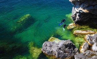
With the Haida Gwaii, Vancouver Island forms part of a partially submerged chain of the Western Cordillera and is a continuation of the US coastal mountains. Its coastline is very rugged, especially on the west, where there are several fjordlike inlets - the longest being Alberni Inlet and Muchalat Inlet - that cut into a heavily forested, mountainous interior. The highest peaks are Golden Hinde (2200 m), Elkhorn Mountain (2195 m) and Mount Colonel Foster (2135 m) within Strathcona Provincial Park, and Victoria Peak (2163 m), which lies north of the park.
In contrast to this mountainous core are the coastal lowlands, which form an almost encircling belt. They are most pronounced in the north and east where the Nahwitti and Nanaimo lowlands form part of a coastal trough stretching from southeastern Alaska to the Puget Depression in Washington state.
Vancouver Island has numerous freshwater lakes, the largest being Nimpkish, Cowichan, Buttle, Sproat, Great Central and Campbell. There are no dominant river systems on the Island, although numerous rivers open up to the coast through broad valleys and terminate in extensive delta and estuary complexes. These include the Nimpkish, Campbell, Somass, Salmon, Gold, Nanaimo, Nitnat and Cowichan rivers. Many of the Island's numerous other rivers and creeks are characterized by steep and narrow valleys, reflecting the rugged topography, particularly on the west coast.
The climate of Vancouver Island is damp but mild, with precipitation ranging over 3 m in the western flanks of the mountains to less than 0.8 m in the southeastern Nanaimo Lowland. Much of the precipitation is received in the winter and returns to the Pacific through a series of rapid-flowing, deeply incised, relatively short rivers such as the Nanaimo and Campbell.
Indigenous People
Although the archaeological record is still incomplete, it is clear that Indigenous people have occupied Vancouver Island for several thousand years. A tribal village society evolved with an economy based on fishing, collecting and hunting. The abundant marine and forest resources along the coasts supported a culture rich in oral tradition and artistic expression. Two main linguistic families, Salishan and Wakashan, developed and continue to exist.
Traditionally, villages comprised stoutly constructed cedar longhouses and were usually situated in sheltered coves or a short distance upriver from the ocean. During the hunting season bands migrated through well-defined territories. In the early 19th century the Indigenous population was about 15 000. Owing to disease, it declined to about 5600 in 1881, remained around 5000 until the 1950s, but increased to more than 7000 by the 1970s. The number is now double of what it was the 19th century, or 5% of the Island's population. (See also Ditidaht, Nuu-chah-nulth, Pacheenaht, Ahousaht, Chickliset, Ehattesaht, Hesquiaht, Mowachaht, Muchalaht, Nutchatlaht, Opetchesaht, Sheshaht, Tla-o-qui-aht, Toquaht, Uchucklesaht, Ucluelet).
Exploration
Spanish, Russian, French, British and American explorers and traders began penetrating the waters of the northeastern Pacific in the 18th century. Britain gradually ousted the others, however, through the activities of its trading companies, the Royal Navy's presence and negotiation and threat in Europe. The voyage of James Cook and George Vancouver's circumnavigation and hydrographic survey of Vancouver Island (1792-94) provided the basis for increased British penetration. The diversity of place names with which the Island and its surrounding islands and waters abound are a permanent record of this exploratory period.
Settlement and Development
In 1843 the Hudson's Bay Company sent James Douglas to Vancouver Island to select a site for a fort, and a small settlement at the southern tip developed around Fort Victoria. The Treaty of Washington (1846; see Oregon Treaty) established the Island as British territory; it was made a British crown colony in 1849. Vancouver Island united with the mainland BC colony in 1866, and the united colony entered the Dominion of Canada as the province of British Columbia in 1871.
The European population grew slowly until the late 1850s, when the discovery of gold on the mainland (see Fraser River Gold Rush; Cariboo Gold Rush) and coal on the Island led to a significant increase. Some of those disappointed in the gold fields turned to farming and coal mining and joined a growing trickle of settlers carving out homesteads on the narrow eastern lowlands.
Besides Victoria, early settlement centered on the Duncan area of the Cowichan River valley and the Courtenay-Comox region, both attractive and fertile valleys. Although the forest was an obstacle to the pioneer farmer, its vast size and the high quality of its trees stimulated the growth of lumber mills at points accessible to tidewater, such as Port Alberni (1861) and Chemainus (1862). The Esquimalt and Nanaimo Railway (1886) provided the basis for expanding the Island's lumber and mining industries. By 1900 the population had grown to around 51 000, with nearly 90% concentrated in the Victoria-Nanaimo region.
After 1900 the pace of development increased rapidly as immigration continued and the mining and lumbering industries developed. Nanaimo expanded and new coal mines were opened at Cumberland, Ladysmith and Union Bay. Population growth slowed between 1921 and 1941, as little suitable land for agricultural development remained; the exhaustion of the best coal deposits left further development to the expansion of the forest industry. The potential for tourism was also becoming apparent as transportation facilities improved and as the attraction of the Island as a retirement area grew.
Economy
The evolution of Vancouver Island's economy has been strongly tied to its rich endowment of natural resources. This endowment has helped create a solid economic base leading to the development of healthy communities and a well-developed social and economic infrastructure throughout all areas of the Island.
As with any resource-dependent economy, Vancouver Island has suffered the effects of "boom or bust" economic cycles. Since the 1980s, however, the Island has experienced change that extends beyond the cyclical swings of the international economy. Indeed, many industries such as the forest industry have made permanent structural changes in order to remain competitive in the global marketplace. At the same time, many new industries and businesses have been attracted to Vancouver Island by its outstanding "quality of life" features. Examples include high-technology firms, recreation and tourism and small manufacturing.
Population
Communities on Vancouver Island also show a remarkable degree of variation. In the northern and western areas of the Island, they rely heavily on the forest sector as a source of income. During recent years, with low world prices for forest products, particularly pulp, and downsizing of the industry, these communities have experienced considerable hardship. This has resulted in higher levels of unemployment and social assistance and, in some cases, population declines as people have chosen to move away.
By contrast, communities on the southern and eastern portions of Vancouver Island are highly diversified and are experiencing vigorous population increases, which in turn is fuelling economic growth. The population of the Island was 495 000 in 1981 and 663 000 in 2001, an increase of 34%. Much of the growth occurred in the Capital and Nanaimo regional districts. Most of the population on the Island lives in urban areas (nearly 80%). In many instances this growth represents its own problems, such as traffic congestion, soaring property and housing prices and urban and rural sprawl. These and other problems challenge the Island's otherwise attractive quality of life and have lead to much discussion and conflict, including the debate surrounding the Vancouver Island Land Use Plan prepared by BC's Commission on Resources and Environment (1994).