Share on Facebook
 Share on X
 Share by Email
 Share on Google Classroom
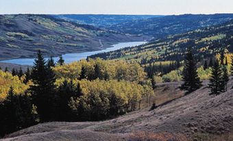
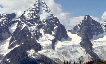
National Atlas of Canada
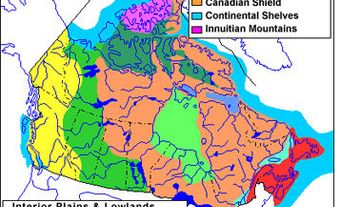
The Atlas of Canada, published by the Department of the Interior in 1906, was one of the world's first national atlases. A second edition similar in style and content was published in 1915, featuring thematic maps dealing with Canada's geology, communications, natural resources, population, economic activities, as well as maps of principal cities. No new edition appeared until 1958 when, stimulated by the International Geographical Union and the Canadian Social Science Research Council, the Department of Mines and Technical Surveys published a third edition, this time 110 sheets in a loose-leaf binding. These maps emphasized the nature, extent and use of the physical resources of Canada, and their effect on the economy and society of the country. For the first time, an edition in French was also produced.
Between 1969 and 1973, the Department of Energy, Mines and Resources issued sheets for the fourth edition, now titled The National Atlas of Canada. In 1974, for the first time, a commercial publisher, The Macmillan Company of Canada, entered into a joint venture with the department to produce English and French versions of a conventionally bound version of this atlas. The fifth edition was begun in 1978 and completed in 1994. Its publication format was a series of large, unbound sheets covering a broad variety of themes, including the exploration of Canada, climate, Aboriginal peoples, resources and socioeconomic patterns.
Going Digital
While the National Atlas continues to offer printed versions of reference base maps, its main activities since 1994 have been producing new thematic maps on the INTERNET and the distribution of digital data via the Internet as well as through map retailers. The atlas concept has evolved into a GEOGRAPHIC INFORMATION SYSTEM (GIS), which provides access to geo-spatial data sets about Canada at a national scale. The shift to digital mapping was driven partly by economics, but also by the need to update maps more frequently and provide current data in a variety of electronic formats.
The atlas's main website has a feature called "Make a Map," which allows users to create customized maps showing the particular layers of information they require, such as lakes and rivers, political boundaries or roads. The user can then select one or more themes (such as endangered wildlife, languages in Canada or natural hazards), and then add these to the base map.
The National Atlas also maintains a website as part of the federal government's SchoolNet. In addition to materials found on its homepage, the atlas's SchoolNet site features geographical facts about Canada, an atlas of Canadian communities and links to map resources useful for teachers and students. The National Atlas is now produced by the Canada Centre for Remote Sensing, a division of Natural Resources Canada.