Share on Facebook
 Share on X
 Share by Email
 Share on Google Classroom
Settlement
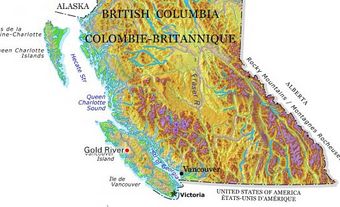
The arrival of White settlers to the area, traditionally inhabited by the Dane-zaa (Beaver) people, began with Hector Tremblay in 1898. Tremblay established a trading post, and the village gradually grew. Pouce Coupe Prairie, as the surroundings were known, was one of the first areas settled in the parcel of land called the Peace River Block when it was opened for homesteading in 1912 (see also Peace River). As a result, the village of Pouce Coupe has been nicknamed “the pioneer capital of the Peace River region.”
Development
In the early 20th century, government offices, a Red Cross Outpost Hospital (see Red Cross Society) and a creamery were located in the village and served the mixed-farming area. During the Great
Depression, many farmers from drought-stricken southern Saskatchewan and Alberta migrated to the Peace River Block via the Northern Alberta Railway, which served the area from 1931 to 1974.
Today, Pouce Coupe’s primary industries are agriculture and petroleum. In November 2009, a natural gas pipeline operated by Encana burst near the village and released toxic hydrogen sulphide (see Sulphur). Eighteen residents were forced to evacuate before the leak was stopped.