Share on Facebook
 Share on X
 Share by Email
 Share on Google Classroom
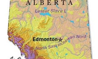
High Level, Alta, incorporated as a town in 1983, population 3641 (2011c), 3887 (2006c). The Town of High Level is located 250 km north of the town of PEACE RIVER and was named for a high expanse of land separating the Hay and PEACE river systems.
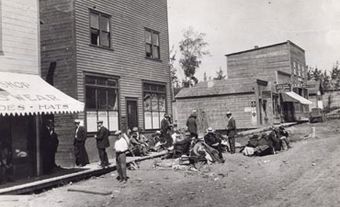
In the late 1700s the site, known by the Slavey as Tloc-moi (meaning "hay meadow"), was used a stopping place for trappers doing business at FORT VERMILION. High Level Crossing began in 1939 as a stopping place on the Dominion government's winter road between GRIMSHAW and Great Slave Lake. It expanded with the completion of the MACKENZIE HIGHWAY after World War II, and was provided with a post office in 1958. When the Great Slave Lake Railway passed through in 1963, High Level continued to expand, and in 1965 it was incorporated as a new town.
The town's economy is based largely on its status as a transportation service center and High Level has become the main trade and service centre for the Northern Peace region. Oil and natural gas discoveries at Zama and Rainbow Lakes to the west during the 1960s added to the economy, as did the establishment of several forestry plants nearby in the 1990s. The Mackenzie Crossroads Museum holds a wealth of artifacts illustrating the history of the district.